
Lodi Neighbors Source Coverage
Nearby parcels are best researched in layers. A Lodi assessment record supplies the Lodi tax account’s property relationship. The Bergen map shows a Lodi parcel’s position beside other polygons. The County Clerk can identify a recorded Lodi instrument for a particular parcel, and Lodi community organizations can point to public events or historical collections. None of those sources is a complete list of people on a Lodi block. Keep Lodi owner records, parcel geometry, civic contacts, and dated historical entries separate.
| Source | Block information | Access |
|---|---|---|
| Lodi assessment search | Lodi parcel-linked owner relationship, block, lot, and possible mailing distinction | Public lookup; it does not prove occupancy |
| Bergen County Parcel Viewer | Adjacent Lodi parcel geometry, address, PIN, and map context | Public map; lines are not a survey or title finding |
| Bergen County Clerk | Recorded Lodi parties and instruments for a parcel or legal description | Online land-record index from January 1, 1970 |
| Lodi Memorial Library | Lodi historical directory, newspaper, and local-history leads | Collection access; not a current neighbor roster |
| Lodi Community Relations Division | Official Lodi civic-program contact and event context | No resident or block roster identified |
Lodi parcel ownership and household membership are different facts. A Lodi mailing address may differ from the property address, some owner fields may be redacted, and a recorded party may be historical. Describe a Lodi owner record as property-linked unless a lawful source expressly establishes something more.
Lodi Neighbor Parcel Keys
For Lodi parcels, the county’s parcel REST layer documents useful map attributes: PAMS_PIN, address, municipality or town, block, lot, qualifier, last update, acreage, tax map, and additional-lot fields. Its schema can also contain an owner-name field, subject to redaction. These Lodi identifiers have different purposes. The Lodi assessment block, lot, and qualifier identify the local tax record, while PAMS_PIN is a Lodi parcel identifier and the Clerk’s book or page belongs to a recorded instrument.
The captured Bergen parcel schema shows the field structure behind the county layer.
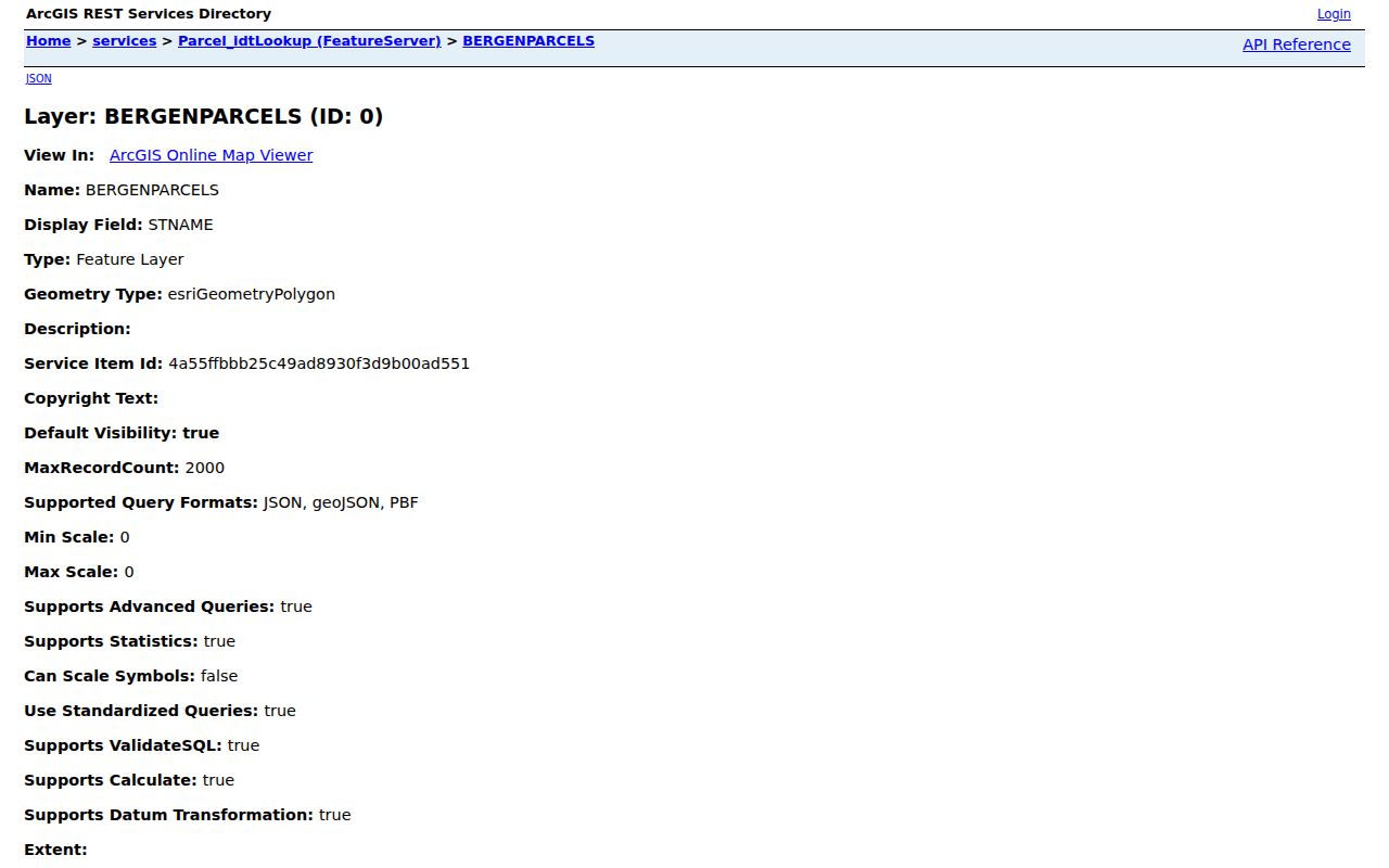
Write each Lodi identifier beside its source and checked date. A PIN is not a deed number, a map feature is not a legal boundary, and an owner field does not create a household list. The live Lodi viewer’s exact search and identify labels were not captured, so no undocumented button or radius tool should be assumed.
Mapping Lodi Block Parcels
Use a controlled, immediate-block method for Lodi neighbors. First anchor the known address in the assessment search, then carry its parcel identifiers into the county map. The parcel viewer can provide geographic context for adjacent polygons, but it is not a title opinion and should not be used to infer who belongs to a household. Only record an adjacent parcel when the live map or GIS staff confirms the relationship. Do not substitute an assumed buffer or radius feature for the observed map workflow.
- Search the known Lodi address in the assessment portal. When using an address, enter the street number and name without a suffix, then retain block, lot, qualifier, and the displayed assessment relationship.
- Open the same parcel in the Bergen map and note its PAMS PIN, address, block, lot, and map date. Compare the municipality field before moving outward.
- Pan or zoom only to the adjoining polygons. If the live interface confirms an adjacent parcel, record its address, PIN, block, lot, source layer, and any lawfully displayed owner field.
- For a recorded transfer question, search the County Clerk by Lodi legal fields and party name. For a full named-street record chain, use the dedicated street directory route.
The Lodi street directory follows a named street more broadly. Keep this method confined to the immediate block, and preserve the difference between a map-neighboring parcel, an owner record, and a person who may live there.
Lodi Neighbor Deed Records
A neighboring parcel’s deed can identify recorded parties and the instrument connected to that parcel. The Bergen County Clerk land-record index provides online coverage from January 1, 1970 to the present. Search by party name, date range, document group, book and page, Clerk’s file number, or Lodi legal fields such as town, block, and lot. Name variants matter, especially where a common name returns many records.
Preserve the party role, instrument type, recording date, book or file reference, municipality, linked-document status, and image availability. A grantor or grantee is an indexed party to a recorded document. That is not a household list, proof of current residence, or a conclusion about anyone not named in the instrument. Older ownership work needs the Clerk, archives, or another repository route after the online cutoff.
For a broad party search, add the Lodi legal fields and a date range before reading a result as parcel-related. Linked documents can explain whether an assignment, satisfaction, release, or correction changes the trail. If legal proof is required, obtain the appropriate certified copy or seek a title professional. The parcel map remains geographic context, not a replacement for that document review.
Lodi Neighbor Voter Limits
New Jersey’s statewide voter system includes address, ward, and district concepts, but access to data is restricted by Title 19 and OPRA. The public voter-status interface did not expose its live fields in the research capture. Original forms and sensitive identifiers are restricted, and Daniel’s Law protections also apply. That means a block researcher should not expect a streetwide roster from a status search or assume a missing display settles a person’s status.
For a defined election-administration question, the Bergen elections offices can explain permitted records and district information. Keep election material limited to the lawful purpose and requested field. Voting history, signatures, and protected data are not shortcuts for identifying Lodi neighbors.
The statewide system may maintain a name, address, ZIP, ward or district, registration date, and participation data, but the existence of those fields does not mean every field is open for public use. Original forms are restricted and public materials require redactions. Record only information the authorized source lawfully supplies, then keep its office, date, and access limit with the note.
Lodi Community Contact Leads
Community sources can help identify a program, collection, or public contact without pretending to supply a neighborhood roster. No authoritative borough-maintained list of neighborhood associations or block groups was located. The resources below are useful for civic context, local history, and organization leads, with each source’s limits kept clear.
| Resource | Contact or collection lead | Limit |
|---|---|---|
| Lodi Community Relations Division | Official civic programs, National Night Out, youth activities, and military memorial information | Official contact, not a resident roster |
| Lodi Memorial Library and BCCLS | Local history, directories, newspapers, yearbooks, and catalog research | Holdings and access should be confirmed |
| Lodi Chamber of Commerce | Local business and civic organization membership or contact context | Organization-supplied and incomplete |
| Bolger Heritage Center | Regional directories, maps, church histories, newspapers, and family files | Original items are appointment-only |
The Lodi Community Relations Division is an official civic contact for programs such as National Night Out and the Junior Police Academy.
Its public activities show where civic information may be found, not the names or addresses of participants. For historical membership or organization leads, the library and Bolger collections are more suitable research channels.
The Lodi Chamber of Commerce describes a civic organization of local businesses working with government and the Board of Education.
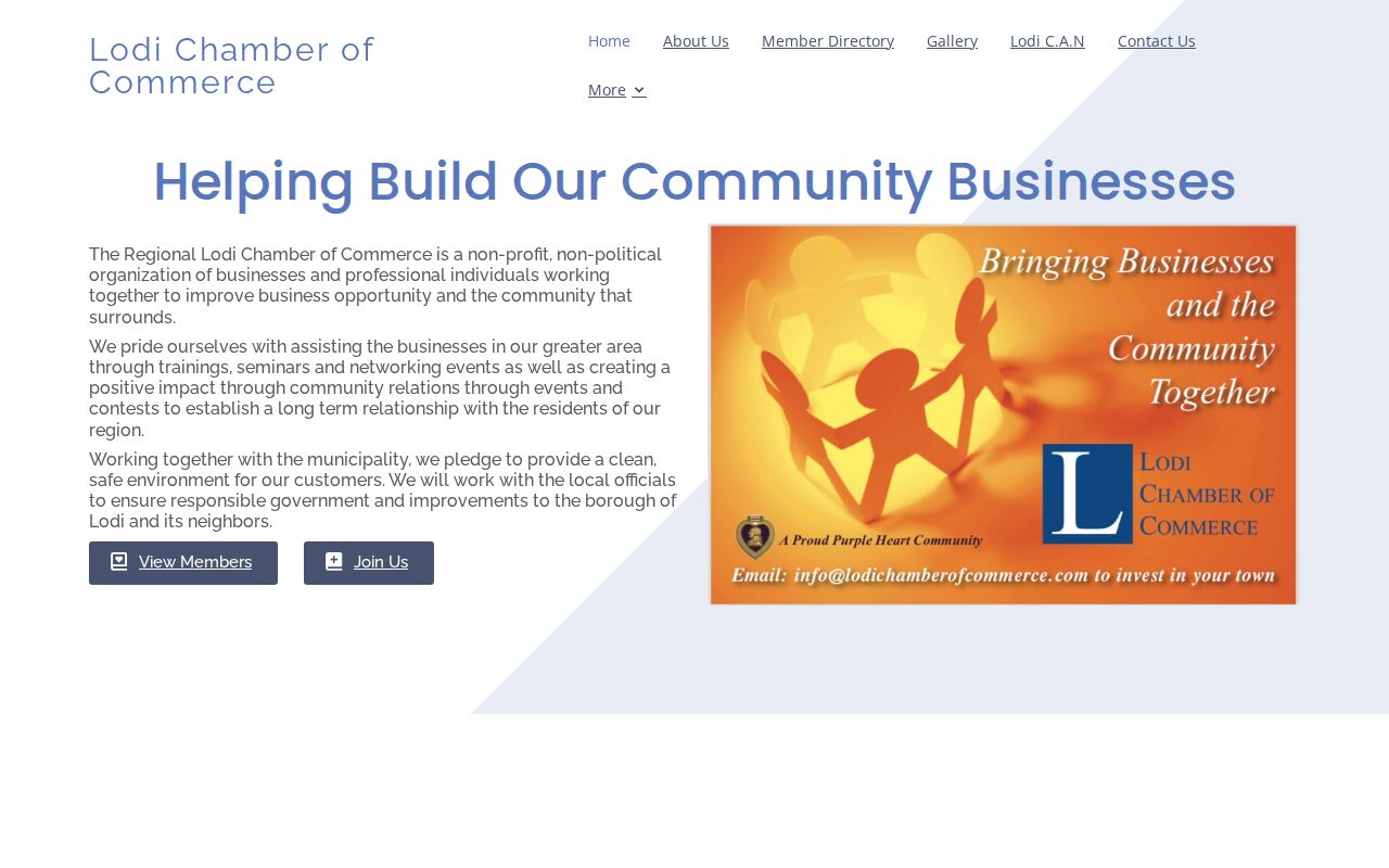
Its membership information can be a community lead, but it is not government data or a complete picture of any block.
Lodi Neighbor Tool Differences
Official records and commercial neighbor tools answer different questions. A county map or Clerk index identifies a defined record source and its date. Commercial tools may combine address, deed, marketing, and brokered data, but they can be stale or merge separate households. Use a public source to verify a specific record, then keep any inference narrow.
| Source type | Best use | Key limit |
|---|---|---|
| Official assessment and parcel records | Locate a parcel and its property-linked attributes | Not proof of household membership or occupancy |
| County Clerk index | Check a recorded party and instrument | Not a complete ownership history or resident list |
| Community and repository sources | Find public programs or historical collection leads | Not a current block directory |
| Commercial neighbor tools | Generate a lead to verify elsewhere | May be stale or combine different households |
That difference matters in a compact borough. Use the official parcel or deed record as the reference point, and do not republish an unverified commercial match as a fact about Lodi neighbors.
Lodi Neighbor Privacy Limits
Many facts about a block are not public neighbor data. Household members who are not indexed owners or permitted voters, utility customers, DMV records, private deliveries, sealed or protected voter records, and unrecorded moves remain outside this research method. The Address Confidentiality Program gives qualifying participants a substitute address for state and local agencies, while Daniel’s Law can require redaction of protected information. A parcel owner field may also be restricted.
Lawful use. Use Lodi neighbor research for personal curiosity, civic context, family reconnection, or a defined property question. N.J.S.A. 2C:12-10 prohibits stalking, and records must not be used to watch, harass, or intimidate anyone.
OPRA does not override these rules or require a custodian to create a person dossier. Ask for a narrow, identifiable record that the proper office may release, and do not turn a nearby parcel or a dated record into a claim about a person’s current location.
The Address Confidentiality Program does not erase an address already public, but it can protect a participant’s actual address in state and local agency records. Private organizations are not required to accept the substitute address. That distinction is a reason to minimize what is retained from a block search, especially when a record carries a redaction or a protected-address warning.